
BISMARCK — It’s that time of year. Not really spring and not really winter, but somewhere in between. Seems like it just wouldn’t be North Dakota without a tease of nice weather dashed with a late season snowstorm.
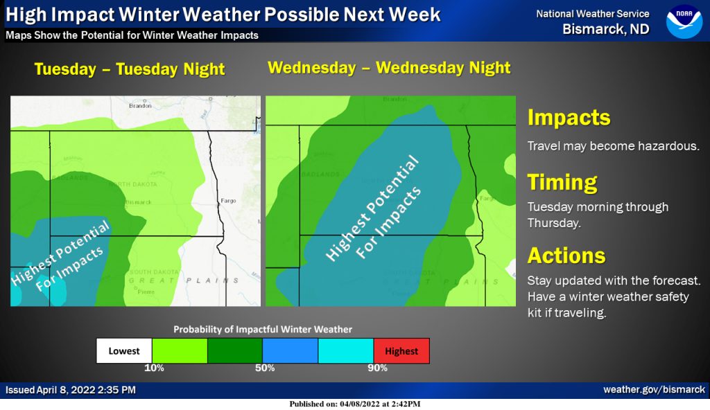
Yikes! It might be best to keep that snow shovel within reach. The National Weather Service issued a Hazardous Weather Outlook early Friday afternoon for most of the state, Minot area included. Enjoy the weekend though, just be prepared for a dramatic weather change next week.
There's still a lot of unknowns with a storm system that isn’t expected to impact the state until the middle of next week. That means there is ample time for the system to change course and avoid much, or all, of the state. Then again, maybe not.
Here’s the Friday afternoon outlook issued by the NWS:
Hazardous Weather Outlook National Weather Service Bismarck ND
This Hazardous Weather Outlook is for portions of north central North Dakota, northwest North Dakota, south central North Dakota, southeast North Dakota, and southwest North Dakota.
Saturday through Thursday
Confidence continues to increase in regards to the potential for a large winter storm during the middle of next week. Uncertainty remains in regards to the exact track, timing, strength, and precipitation types at specific times for specific locations, all factors of which will affect snowfall totals.
Monitor the latest forecast, especially if you have travel plans during this time period.