BISMARCK — The recent blizzard that tore through much of the state was certainly one for the memory, and it set, or nearly set, new records for snowfall at many locations.
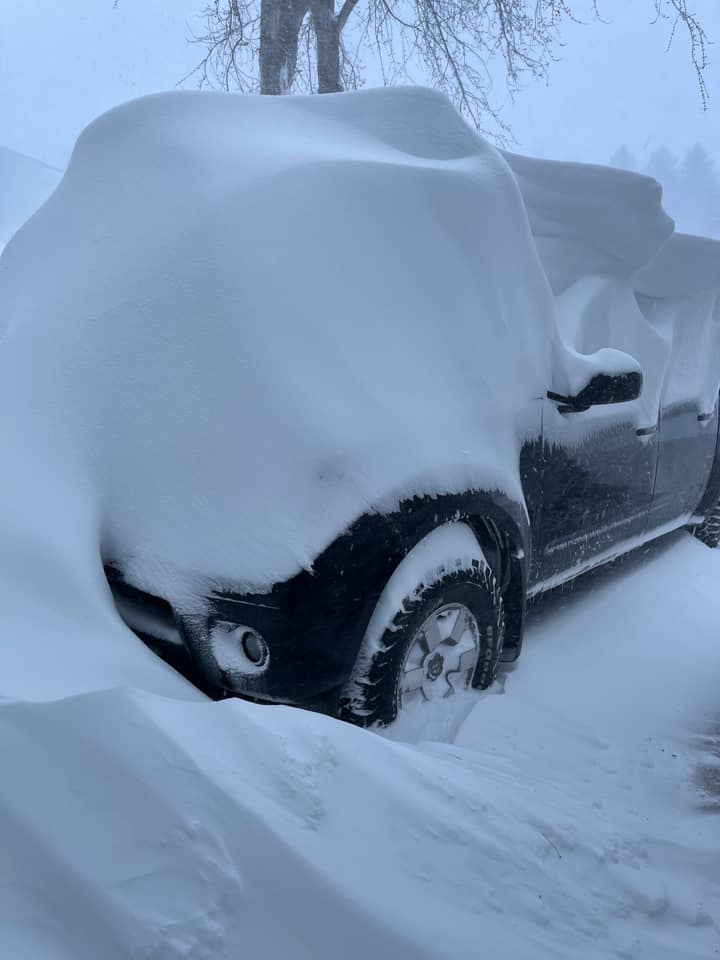
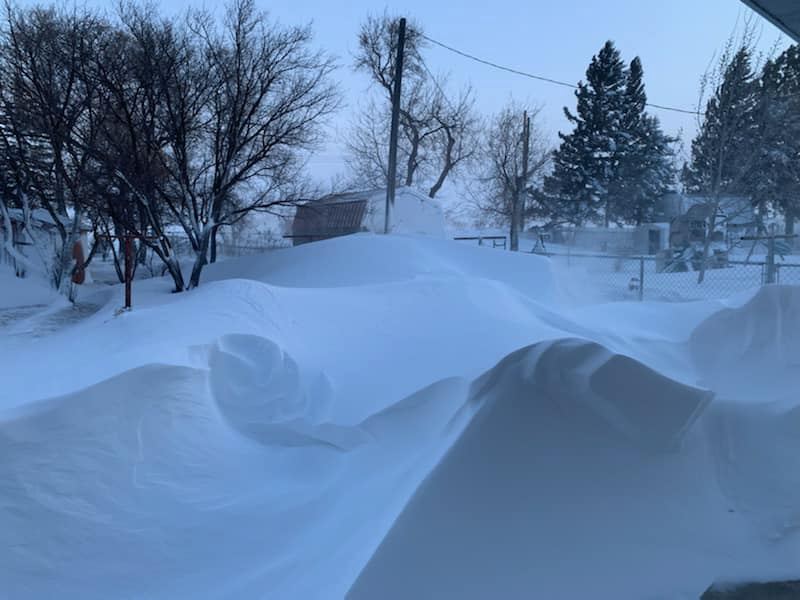
The National Weather Service has compiled data from the storm, showing just how impactful the storm was from a historical perspective. In addition, many people shared with the NWS photographs taken during and after the blizzard.
Here’s a summary of the storm provided to The Dakotan by the NWS:
Overview
A significant winter storm brought widespread blizzard conditions to western and central North Dakota from April 12 through April 14, 2022.
Snow began in southwestern North Dakota early in the morning on Tuesday, April 12, and quickly expanded into central North Dakota during the morning hours, then gradually into northern North Dakota through the rest of the day. Conditions deteriorated rapidly due to heavy snow and high winds, with a No Travel Advisory issued by the NDDOT by late morning for much of the southwest and south central. At 5 p.m. on Tuesday, Interstate 94 was closed from the Montana state line to Jamestown. Many roads were difficult to impossible to travel on due to blowing and drifting snow.
Heavy snowfall rates continued Wednesday, and winds shifted to the northwest with many gusts reported around 60 mph. Blowing and drifting snow remained a significant problem.
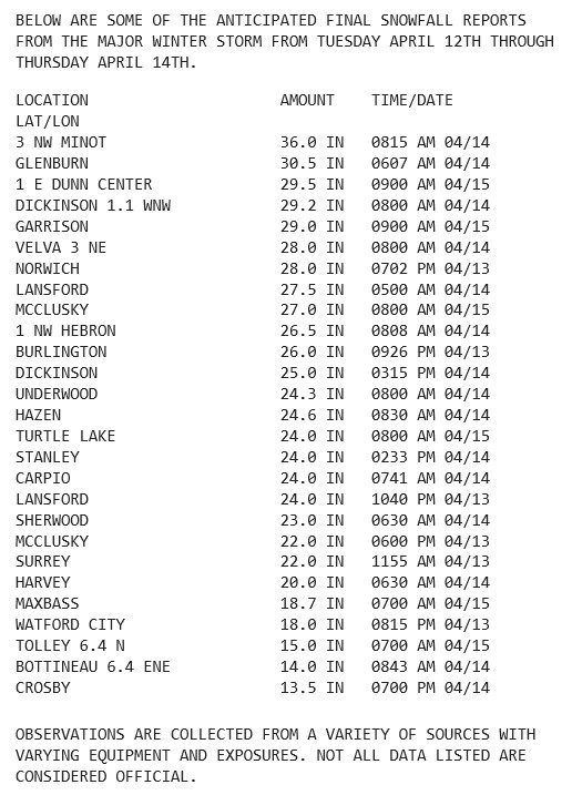
Overall snowfall was 1 to 3 feet, with drifts exceeding 8 feet!

Minot led the state with the highest recorded wind gusts during the epic blizzard.
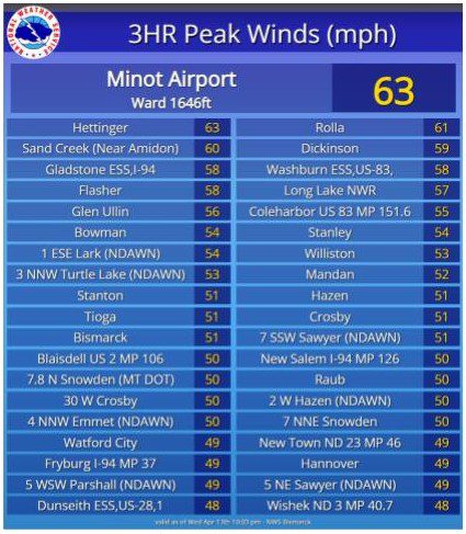
NWS Storm Reports