Key Messages
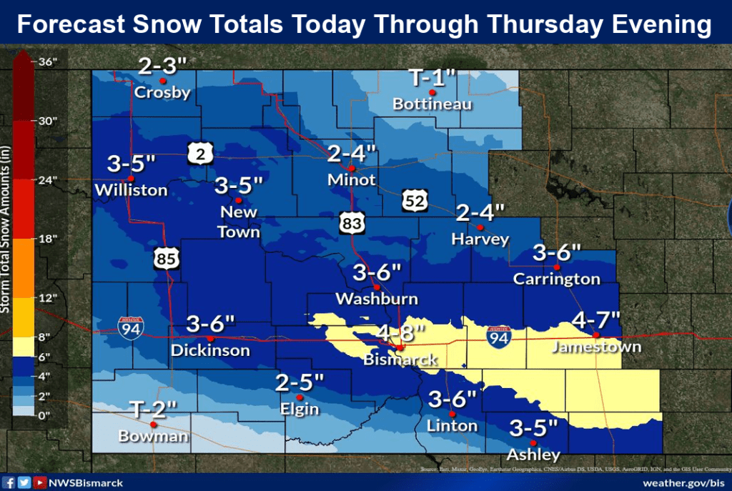
● High chances (90%) for accumulating snow Wednesday afternoon through Thursday evening.
● Highest snow amounts Wednesday afternoon through Thursday evening expected from Williston to Bismarck and Jamestown to Lisbon, North Dakota.
● Medium to high chances for more impactful winter weather this weekend, especially southern North Dakota.
A second and potentially more impactful snow event is expected to hit the state from west to east Saturday afternoon through Sunday. The NWS says there is still some uncertainty in forecasting the system, but early analysis of forecast models concludes up to 6 inches of snow is up to an 80% possibility, 12-inch snow 50%, and 18 inches of snow a 25% possibility.
To keep up to date on both these weather systems go to: https://www.weather.gov/media/bis/DssPacket.pdf