
MINOT — Not too hot. Not too dry. Perhaps just right.
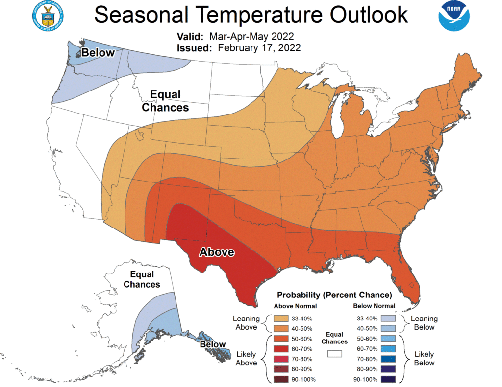
The latest three-month outlook issued by the Climate Prediction Center places North Dakota in the “equal chances” category for March-April weather. That means there are no strong indicators of higher or lower than normal temperatures, or greater or less precipitation throughout the period.
The CPC says La Nina “continues to be the major driver of the predicted climate during March, April, and May.” La Nina is a cooling of Pacific Ocean temperatures that influences weather patterns across the U.S., generally translating to colder than usual temperatures across North Dakota.
While a sizable portion of northwest Montana, and about half of South Dakota, is favored for warmer than normal temperatures in the coming months, North Dakota is not. The state is expected to have temperatures fall within historic norms, neither warmer or colder, on average, than usual.

North Dakota’s March through May precipitation outlook mirrors the temperature expectations. There is no clear indicator for forecasters to conclude the state will receive more, or less than, normal precipitation throughout the 90-day period. However, says the CPC, the “probabilities for below normal precipitation have increased across much of the West,” not including North Dakota, through September 2022.
Long-range weather outlooks issued by the CPC are considered “probabilities” only and are subject to change as global weather patterns develop. The CPC issues its three-month outlooks on the third Thursday of each month.