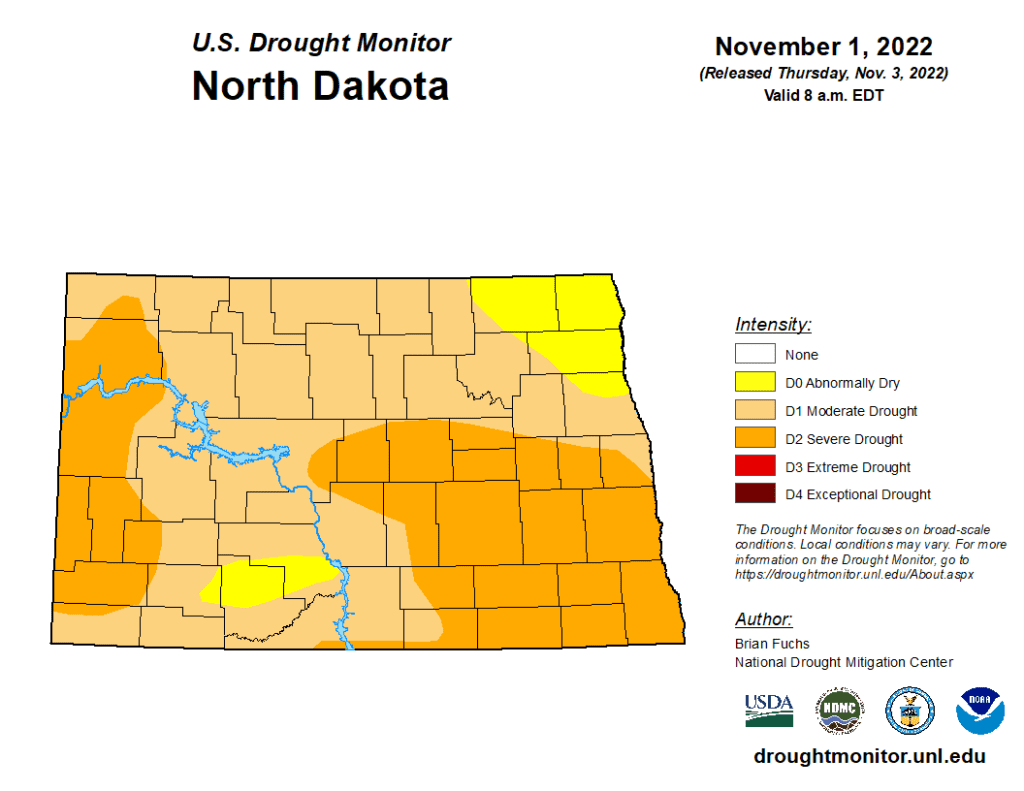

MINOT – What the U.S. Drought Monitor refers to as “flash drought” conditions have crept into much of North Dakota in the past week. The Drought Monitor is issued each Thursday.
A flash drought is defined as the opposite of flash, or sudden, rainfall or flood. It is a rapid intensification or expansion of drought conditions, a result of minimal or no precipitation, high winds, and high temperatures. The state has been experiencing some warmer than usual weather this fall, but the dry and pleasant conditions have aggravated dry conditions.
According to the Drought Monitor, “Temperatures were 8-10 degrees above normal in the Dakotas” this past week and “warm, dry and windy conditions have provided ideal harvest conditions but have started to take a toll on the region. In the Dakotas, a broad expansion of severe drought conditions took place this week.”
A week ago the Drought Monitor identified just 19% of the state as being in the severe drought category. That number has jumped to 40% -- a flash drought.
Dry conditions are not particularly alarming for this time of year as there are several months of winter ahead, ample time to add moisture in the form of snow to the landscape. However, should the present conditions persist, or worsen, it could impact the spring planting season.
Currently, about half the state is rated in the “severe” drought category, with most of the remainder in “moderate” drought. While snowpack, snowmelt, and spring rainfall can quickly reverse ongoing drought conditions, the amount of moisture in the ground heading in freeze-up is significantly less than desired by producers throughout the state.