
MINOT — The region is wet and there’s record flooding occurring in neighboring Montana all along the surging Yellowstone River.
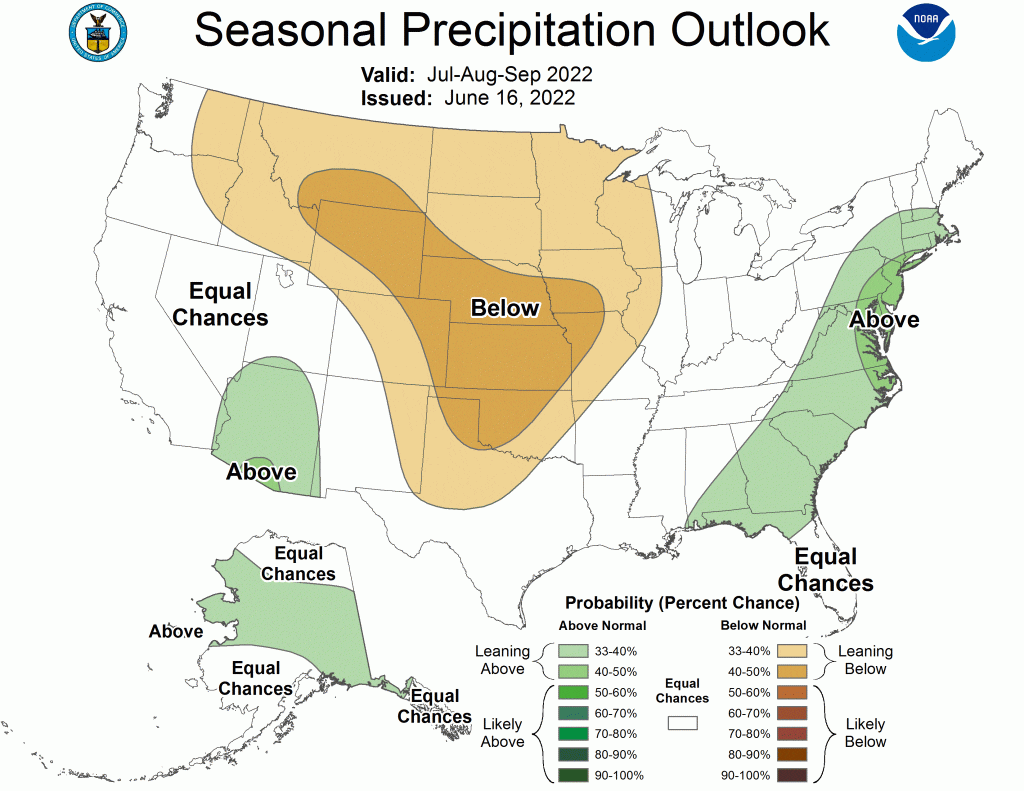
Given those conditions, it hardly seems possible that a weather forecast calls for a dry July-September for North Dakota. However, that is exactly what is contained in the latest long-range issuance from the Climate Prediction Center.
According to the CPC, “below-normal precipitation is most likely for much of the Great Plains,” which includes North Dakota. How much less than normal precipitation is virtually impossible to say in a long-range outlook. What is known is that conditions favor the possibility of three consecutive below-average months of precipitation over a general area. Of course, rainfall can vary greatly within a few miles.
3-Month Temperature Outlook
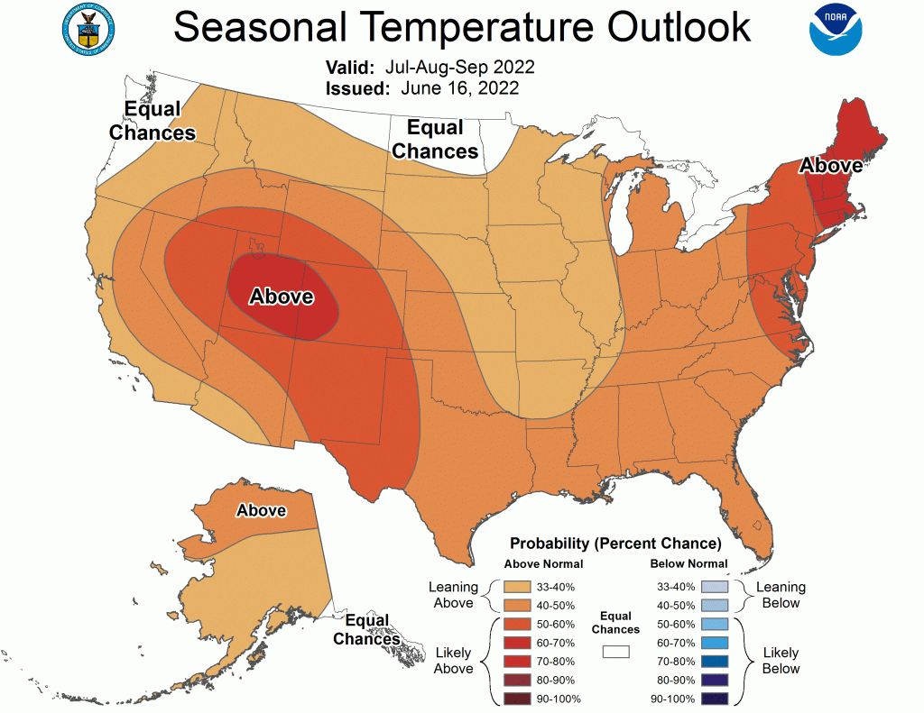
The CPC’s latest temperature outlook for July-September concludes it’ll be much warmer than usual for nearly all of the U.S. in the months ahead. However, that prediction does not include North Dakota.

The CPC rates North Dakota as having an “equal chance” of lower or higher than normal temperatures July-September, meaning there are no current indicators to increase the probability of anything other than “normal” temperatures ahead. The state’s weather history has shown that, on any given day, “normal” can make generous use of the entire range of the thermometer.
La Nina
A La Nina Advisory continues through the end of 2022, with a slight chance of a decrease in the Northern Hemisphere in late summer. However, says the CPC, odds (58-59%) favor a slight increase in La Nina influence during the fall and early winter of 2022. In general, La Nina leads to lower than usual temperatures and increased precipitation across North Dakota.