
RIVERDALE — The latest projected runoff for the Missouri River Basin is less than what was forecast one month ago. Expectations are that the impact will be felt all along North Dakota’s sprawling Lake Sakakawea.
The North Dakota Game and Fish Department issued a statement to coincide with the projections, saying the latest forecast “doesn’t look promising at this time.”
One month ago the U.S. Army Corps of Engineers projected the spring runoff to be 21.7-million-acre feet of water. Now that expectation has been reduced to 20.4 maf. Average is 25.7 maf.
“It’s likely both Lake Sakakawea and Lake Oahe will be 5 to 10 feet lower than the lake elevations experienced in 2021,” stated Greg Power, NDGF fisheries chief. “At these forecasted elevations, boating access at many, if not most of the boat ramps, will become problematic.”
The latest projections have Lake Sakakawea peaking just over 1,832 feet at the end of July, one foot less than the February outlook. The current elevation of Lake Sakakawea is just under 1,828 feet. Spillway level for the reservoir is 1,854 feet.
While large fluctuations in elevation can be expected on Lake Sakakawea, the current level, and the projected levels for this summer, have spurred efforts to ensure recreationists will have ample access to the lake following ice-out, and throughout the upcoming open water season. Boat ramp issues involve a collaborative effort between NDGF, USACE, State Parks and Recreation, and the ND Department of Water Resources.
“Current interagency planning is intended to proactively deal with these boat ramp issues through addressing coordination, permitting, and funding matters yet this winter so that ramp work, where needed, can begin shortly after ice-out,” said Power.
Low water boat ramps were constructed at several locations along Lake Sakakawea during previous low water years. However, most have been underwater for a decade or more.
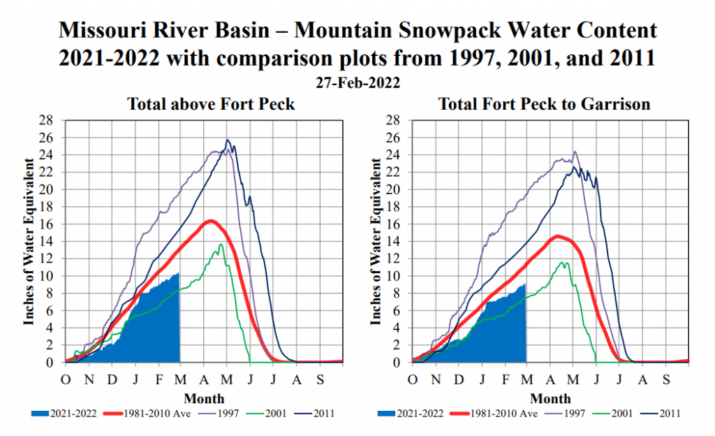
Current evaluation of winter snowpack over the Missouri River and Yellowstone River drainages, which lead into Lake Sakakawea, concludes conditions are presently about 80% of normal. Conditions are subject to change should heavy snowfall, or rain, occur over the drainage. The 30-year average peak for the Missouri River system snowpack is April 15.