
Long-range weather forecasters are in the business of generalizing weather trends, not the day-to-day temperature, wind, or rainfall forecasts. But darn if they aren’t fairly reliable overall.
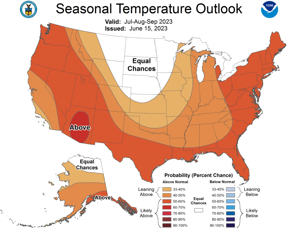
The latest 3-month weather outlook issued by the Climate Prediction Center, for July through September, calls for a greater than normal chance of above-normal temperatures for nearly all of the United States. The exception is North Dakota, South Dakota, and portions of neighboring states.
Yup. North Dakota is in the “equal chances” category for above, below, or normal temperatures in the months ahead. However, when it comes to weather, nothing seems normal in North Dakota. Nevertheless, “equal chances” is better than below or above.

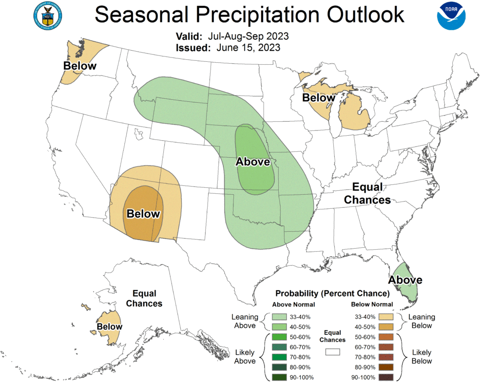
As for precipitation, the CPC says the Plains State should see “above-normal” rainfall through September, with one exception. You guessed it. North Dakota. Our state again falls into the “equal chances” category for above or below normal precipitation. Perhaps even the seasoned forecasters at the Climate Prediction Center realize how unpredictable North Dakota weather can be.
The CPC closely monitors equatorial sea surface temperatures which are key to forecasting La Nina or El Nino conditions. Right now, those water temperatures are on the rise, nearly a degree, but that’s enough to influence what happens with our weather in the upcoming winter.
Fingers crossed, but the CPC says El Nino is expected to strengthen and persist through the winter of 2023-24. For North Dakota, and the northern tier of states, that almost always translates into a warmer than usual winter.