
MINOT – The Minot region and much of the state has been enjoying several days of moderate weather but, according to weather forecasters, that is all about to come to an end. Rather abruptly too.
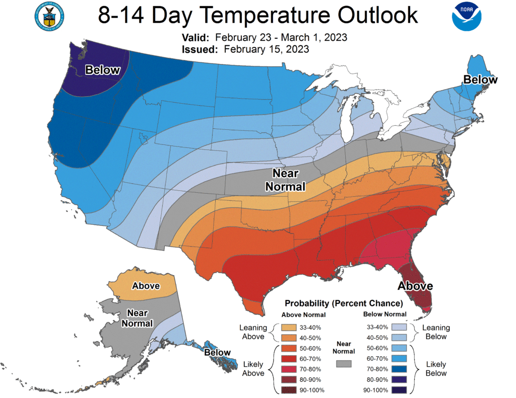
The Climate Prediction Center says they expect a significant weather change for our area, and a good portion of the United States, beginning about the middle of next week. The overall weather pattern, explains the CPC, is for cold temperatures “over the Northern and Western U.S.” February 23-March 1.
As if cold temperatures wasn’t enough nasty news for those who were clinging to hopes of moderate weather leading to an early spring, the CPC adds that the expected cold, which could reach record lows, will likely be accompanied by a “winter storm impacting the Northern tier of states.” Also, notes the CPC, “Enhanced risks of hazardous cold, winds, and heavy snow are expected as early as Feb. 23, 2003.”
It’s too early in the forecast cycle to definitively say what the effect of the expected system will have on Minot and North Dakota, but below zero temperatures, as low as 12 below zero, are already in the forecast for next Wednesday night.
The northern U.S., Minot included, is favored for “below-normal temperatures” for March. Looking further ahead, April-June, the CPC calls for “elevated probabilities of below-normal" temperatures to “parts of the Northern Plains” with precipitation probabilities for the same period to fall within historical norms.