
Strong wind, first measurable snow
The first blast of winter happens every year, ready or not, and you never know quite when. The National Weather Service says the first adverse winter weather of the season is expected to strike the state as early as Thursday.
The NWS issued a Special Weather Statement early Wednesday morning that included a high confidence of strong winds and increasing confidence for the arrival of the first measurable snow of the season, spreading west to east over much of the state through Friday.
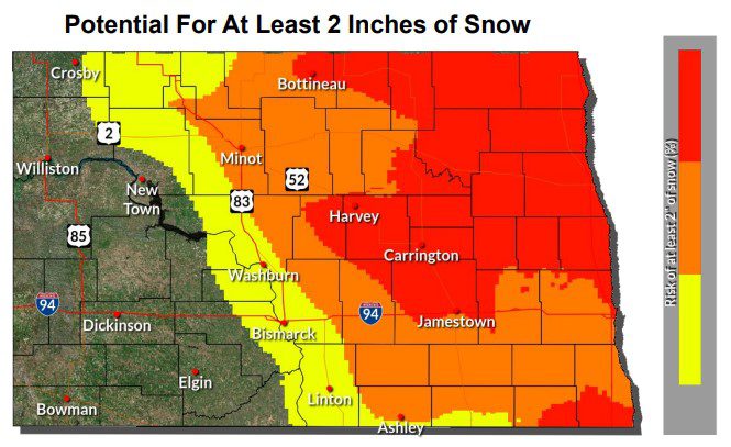
Calling the system the “First Weather Event of the Season”, the NWS says there is potential for at least two inches of snow over much of the central part of the state and the possibility of even greater amounts elsewhere, four inches or more, as the storm spreads eastward.
While snowfall amounts and locations are likely to change as the system approaches, the expected wind is forecast with greater certainty. Winds are forecast to range from more than 50 mph in the southwest part of the state to most all other locales reaching 40 mph or more.
With the high winds and snowfall, says the NWS, travelers can expect reduced visibility and the possibility of slippery roads. Mixed precipitation is likely as the system moves into the state late Wednesday, changing to all snow during the overnight hours.
The Dakotan will provide NWS updates on this weather system as it continues to develop.