BISMARCK — It's the real deal, no escaping this one. A spring storm that is poised to tear into North Dakota has the potential to bury the record book under a massive dump of snow. Add to it plunging temperatures and winds up to 60 miles per hour, and you have all the ingredients of spring blizzard.
The National Weather Service in Bismarck and Grand Forks held a joint briefing Monday morning, saying this storm needs to be taken seriously. Travel throughout the state is expected to come to a standstill with heavy, relentless snowfall shutting down highways and airports alike.
“You won’t be going anywhere for a day or maybe longer,” said the NWS in Grand Forks. “This will be a crippling blizzard. Don’t be surprised if we see some 60 mile per hour winds. Even if it starts out as rain, there’s still the potential for a lot of snow. Heavy snow.”
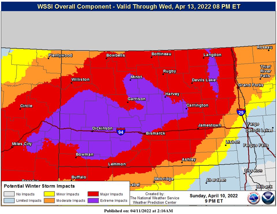
As of Monday afternoon, the NWS expected the storm to hit the Minot area about sunrise Tuesday, dropping up to 31 inches of snow before moving to the east. Other possible snowfall totals across the state included up to 31 inches at Dickinson, 29 inches at Harvey, 28 inches at Washburn, and 27 inches at Bismarck.
“This storm is so big, with such a high impact,” said the NWS. “There’s another system behind this one but nothing as historic as this.”
For the Minot region, the wind is expected to climb close to 40 mph Tuesday before rising into the upper 40 mph range through Thursday, continuing into the mid-30s on Friday.
Here is the official Blizzard Warning issued Monday afternoon by the NWS office in Bismarck:
Blizzard Warning
URGENT - WINTER WEATHER MESSAGE
National Weather Service Bismarck ND
228 PM CDT Mon Apr 11 2022
NDZ001>005-009>013-120400- /O.CON.KBIS.BZ.W.0005.220413T0000Z-220415T0000Z/
Divide-Burke-Renville-Bottineau-Rolette-Williams-Mountrail-Ward- McHenry-Pierce-
Including the cities of Parshall, Glenburn, Dunseith, Sherwood, Minot, New Town, Columbus, Shell Valley, St. John, Portal, Lignite, Rugby, Rolette, Drake, Towner, Velva, Mohall, Bowbells, Rolla, Crosby, Powers Lake, Stanley, Williston, and Bottineau
228 PM CDT Mon Apr 11 2022
...BLIZZARD WARNING REMAINS IN EFFECT FROM 7 PM TUESDAY TO 7 PM CDT THURSDAY...
* WHAT...Heavy snow and blizzard conditions expected. Total snow accumulations between 12 and 24 inches, with locally higher amounts up to 30 inches possible. Winds gusting as high as 50 mph.
* WHERE...Northwest and north central North Dakota. * WHEN...From 7 PM Tuesday to 7 PM CDT Thursday.
* IMPACTS...Travel will become very difficult to impossible. Widespread blowing snow could significantly reduce visibility