
BISMARCK — On the heels of a monster snowstorm, North Dakota residents are more eager than ever to enjoy a little summer-like sunshine and warm temperatures. But is such a change just around the corner? Perhaps not.
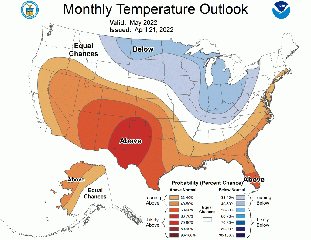
The Climate Prediction Center issued their monthly long-range weather forecast Thursday, and it favors below-average temperatures for much of the state. Normal daytime highs in May range from the low 60s to the low 70s, meaning even some below-normal temperatures shouldn’t get near the freezing mark. Nighttime lows could however, as they average from the upper 30s to upper 40s in May.

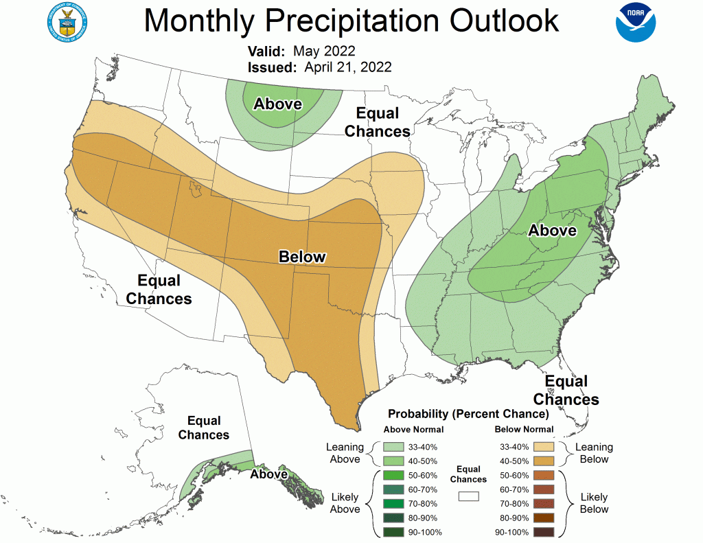
Areas of North Dakota that were short of soil moisture got a much-needed boost from the late April snowstorm. Now, says the Climate Prediction Center, much of the state may get more than their normal share of moisture in May.
The long-term average precipitation for May in Minot is 2.73 inches. While weather averages and norms often take a battering, they do provide an idea of what to expect.
April’s average snowfall for Minot is 4.4 inches, yet the region was blasted with a late-season blizzard dumping three to four feet of snow in its wake. And don’t think May is immune to snowfall. Historic records reveal the white stuff averages 1.8 inches in May.
Looking further ahead, June and July, the CPC says North Dakota’s weather should track along historic norms with no indicators favoring above or below normal precipitation or temperatures.