UPDATE: 9:00 a.m., Jan. 5--The National Weather Service has updated their forecast briefing again. See below for the most recent forecast graphics. For more details, see weather.gov/bis.
UPDATE: 3:30 p.m., Jan. 4--The National Weather Service has updated their forecast charts. See below for the most recent forecast graphics. For more details, see weather.gov/bis.
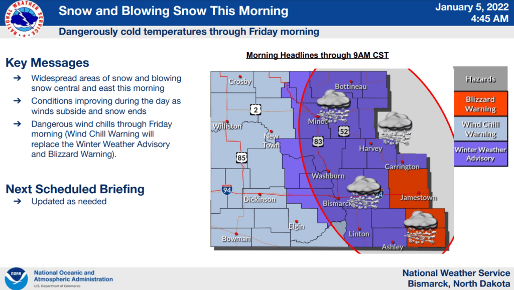
Most of North Dakota will experience dangerous cold weather for the next few days, beginning tonight through Friday night. The forecast minimum wind chill values for that time period will be near or below minus 40º F across nearly the entire state, with wind chill values approaching minus 50º F near the Canadian border.
Additionally, the NE portion of North Dakota is forecast to receive 3-5 inches of snow, with forecast snow totals decreasing from NE to SW across the state. Wind gusts from 30-50 mph will also produce blowing snow.
See the complete National Weather Service (NWS) briefing below. For more details, see weather.gov/bis.