GARRISON — Two boat ramps and accompanying marinas at Fort Stevenson State Park are filled with activity during the boating season. Marina slips are full and parking lots often swelling with tow vehicles and trailers from Memorial Day to Labor Day.
The park’s two boat ramps, one in Garrison Bay and the other in de Trobriand Marina, are measuring points for many water enthusiasts keeping a close eye on low water conditions in Lake Sakakawea. The status of the ramps is a constant question for park staff.
“Not a day goes by when we don’t get a phone call about what we think is going to happen with water levels this year,” said Chad Trautman, Fort Stevenson State Park manager.
Trautman can answer that the park’s main ramp in Garrison Bay has a bottom elevation of 1,800 feet, as deep as any ramp on the huge reservoir. Sakakawea’s elevation Monday was 1,827.86 feet.
“We have 27 feet of water on that ramp, so it is without a concern,” stated Trautman. “Once we get the silt off, we’ll be ready to go. We’ll get a long-reach excavator to remove the siltation in Garrison Bay at the end of that ramp.”
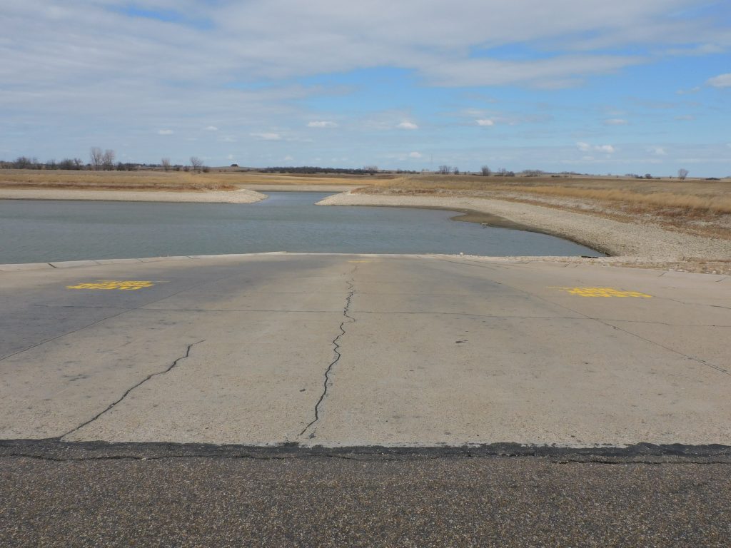
Of greater concern is whether or not the broad ramp on the east side of the park, in de Trobriand Marina, will be useable. It is much shallower on the de Trobriand side of the park than it is in Garrison Bay.
“That’ll be day to day,” said Trautman. “According to our last survey over there, we were at 1,825 in the bottom of the marina.”
While less than three feet of water is too shallow for many of the large vessels and sailboats that have been utilizing the de Trobriand Marina for several years, it might be deep enough to accommodate smaller fishing boats and jet skis.
“We’ll go out there and record elevations so people can decide if they want to launch from that side,” said Trautman. “We’ll see what the channel is like to get out to the main water.”
The boat ramp at de Trobriand Marina is located inside the marina proper, with a narrow cut leading out to Lake Sakakawea. The passageway to the main body of Sakakawea is shallow and, under low water conditions, requires careful navigation by boaters.
One question very much on the mind of Lake Sakakawea users right now is, was there enough moisture in our recent snowstorms to make a difference in projected water levels for Lake Sakakawea? Perhaps, but it takes a few months for mountain snowmelt to enter the reservoir.
Latest snowpack analysis provided by the U.S. Army Corps of Engineers does contain some encouragement for increased runoff. Projections to date have been somewhat dismal, calculating only a small rise for Sakakawea this summer. However, recent snowstorms have resulted in more snow in the western mountains, where the bulk of Lake Sakakawea’s runoff originates.
Latest snowpack water content has increased by 8% over what it was in mid-April. How much of an effect that will have on runoff won’t be known until the Corps issues its May runoff report.